Mobile app · Connected hardware · ADA and PROWAG inspection
ADAM App
About the project
Connect inspection hardware with the person using it. A software interface for Rieker's field inspection system, bringing sensor information and inspection context onto a mobile device.
Want to discuss a similar project?
Discuss software for your inspection hardwareSoftware for Rieker’s ADAM hardware.
We created the software that connects with Rieker’s hardware, so the field system and the phone work as one.
The app acts as the communication and visualization layer between the physical inspection equipment and the user, bringing sensor information and inspection metadata onto a mobile device.
Technology
- React Native
- Socket Streaming
- GPS
- Inclinometer Integration
How it works
The application establishes communication with custom hardware containing cameras and sensors. Real-time sensor information is streamed to the mobile application, where it can be processed and combined with relevant inspection metadata.
The architecture was designed to support field-based workflows where reliable hardware communication and real-time data processing are essential.
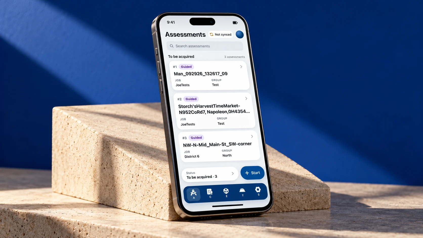
Every assessment, in one list.
Assessments are listed with their number, job and group, and can be searched. A Start button begins a new one, and a status marker shows when data is not yet synced.
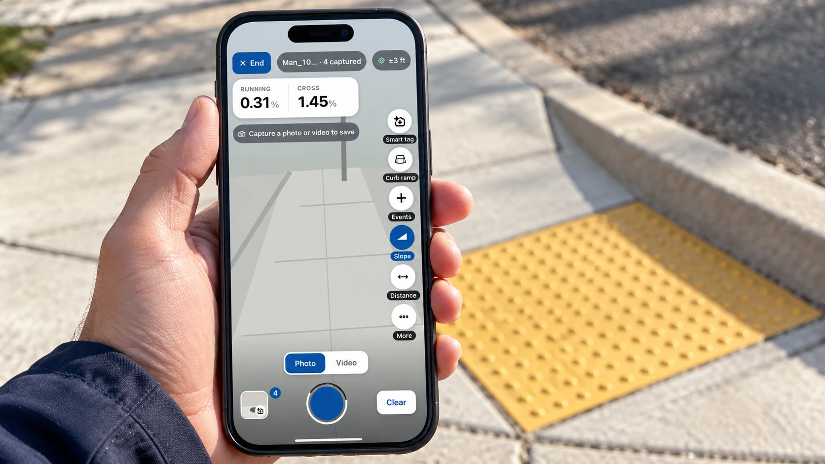
Measure at the ramp.
The camera view carries live running and cross slope readings. Side tools cover Smart tag, Curb ramp, Events, Slope and Distance, and each capture is saved as a photo or video.
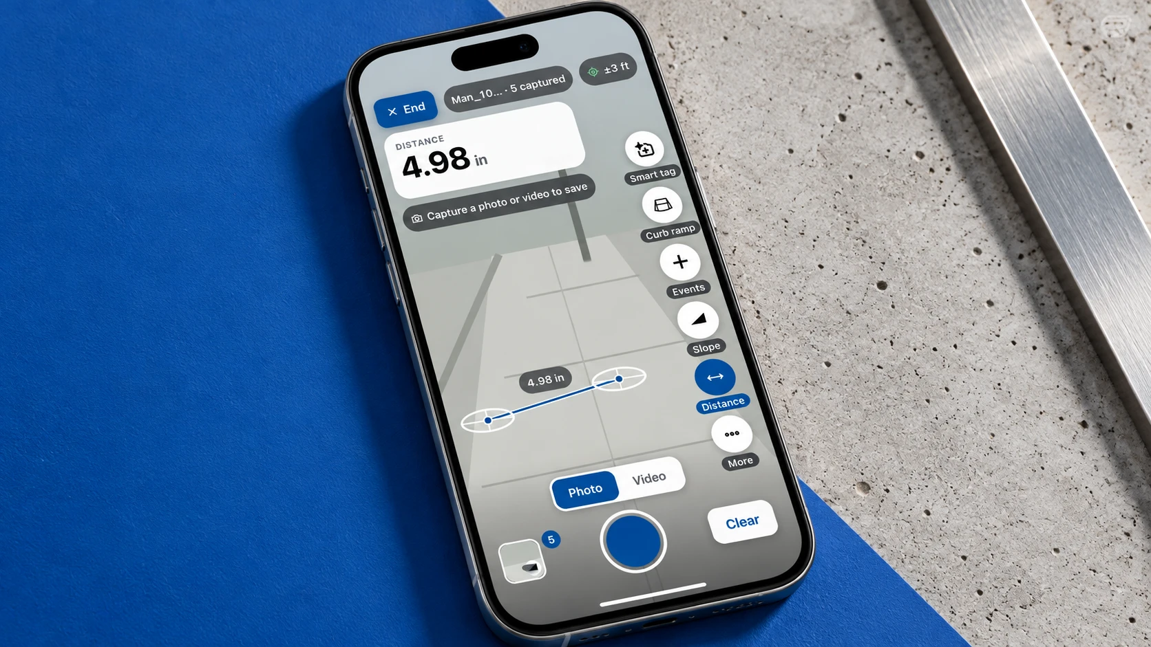
Distance, on the screen.
The Distance tool measures between two points on the camera view and shows the reading beside the capture controls.
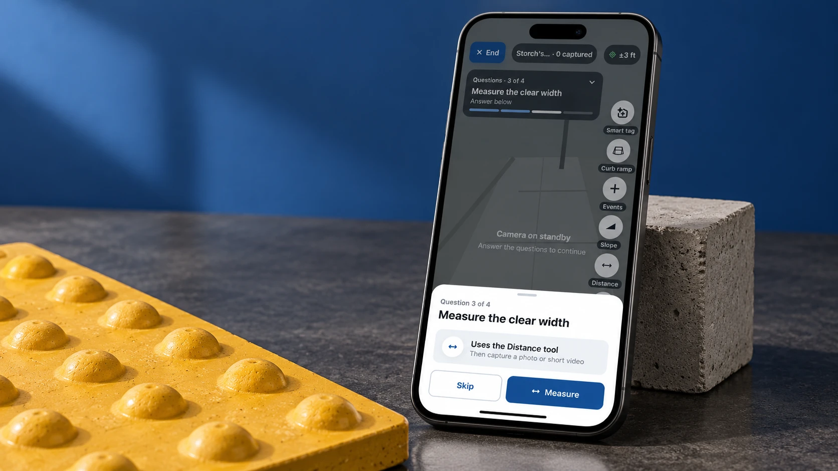
Guided, one question at a time.
Guided assessments step through questions, such as measuring the clear width. Each question points to the right tool, then asks for a photo or short video, and can be skipped.
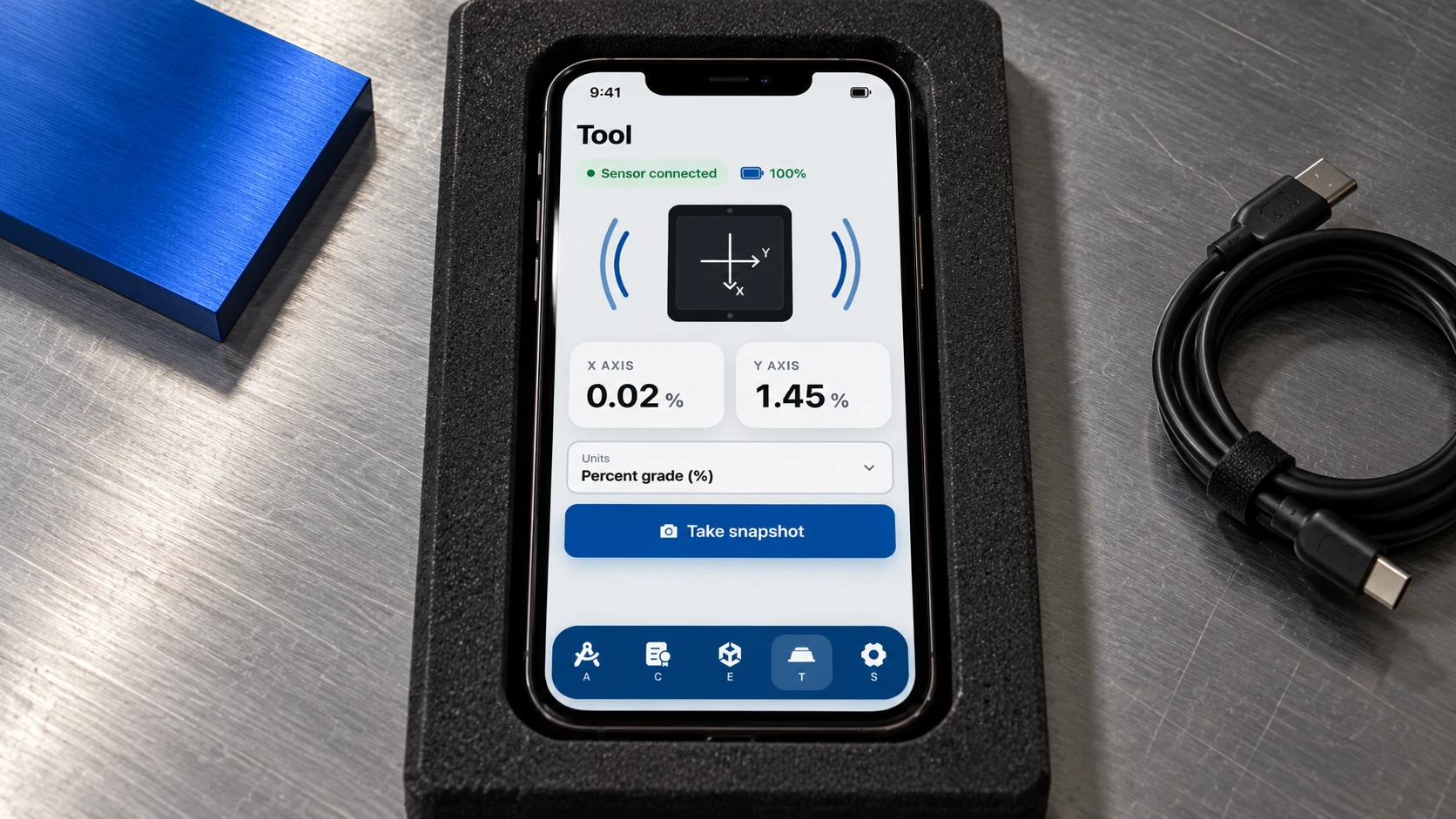
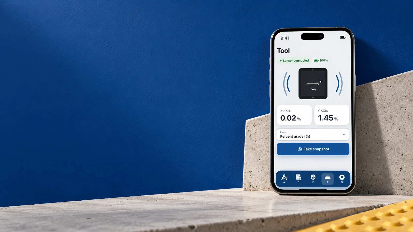
Connected to the sensor.
The Tool screen shows the sensor connection and battery, live X and Y axis readings and the chosen units, with a Take snapshot button.
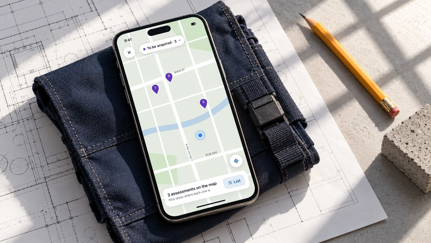
On the map.
Assessments can also be seen on a map, with numbered pins showing where each one is, and a List button to switch back.
How we optimised it.
- 01
Smart inclinometers, computer vision and photogrammetry combine to create a 3D digital copy of the site.
- 02
Rapid data collection on the iOS app reduces field measurement errors and repeat site visits.
- 03
Traceable audit reports, state-specific inspection forms and engineering data are generated automatically.
Sensor information and inspection metadata can be handled within a connected field experience.
What it can do.
- Custom hardware connectivity
- Real-time sensor streaming
- Camera integration
- GPS data integration
- Inclinometer integration
- Inspection metadata processing
- Mobile field workflow
- Real-time data visualization
Every layer, one team.
We handled the application architecture, full-stack development, hardware integration, communication layer, and system-level integration required to connect the mobile application with the inspection hardware.
- UI/UXUser experience and interface design
- ArchitectureApplication design
- MobileReact Native companion app
- HardwareCamera, GPS and inclinometer
- Real-timeSocket streaming layer
- IntegrationSystem-level hardware link
Have a project in mind?
Tell us what you're working on. We'll suggest a clear first step, with no obligation.
Discuss a project